
Projects
Explore a selection of TST Engineering's projects, showcasing the breadth and impact of our work over the years. From groundbreaking innovations to successful collaborations, our portfolio reflects our dedication to excellence and precision. Below, you'll find highlights of both recent and longstanding projects that demonstrate our expertise and commitment to delivering high-quality results in various sectors.
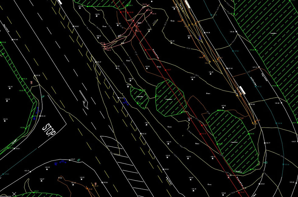
NTA Tallaght to Clondalkin Cycle Scheme


Dublin, Ireland
Under the NTA (National Transport Authority) Framework, TST has been appointed to carry out the Topographical and Utilities Mapping Survey for a 32.5-hectare area. The survey will include detailed mapping of national roads and the LUAS (Light Rail Transit) track, which is vital for local transportation. The scope of the survey covers the identification and documentation of topographical features, as well as the location and condition of existing utilities such as water, sewerage, electricity, and telecommunications infrastructure. The data collected will play a crucial role in informing future infrastructure projects, supporting urban planning efforts, and ensuring the efficient management of transport and utility systems within the region.
DCC Oliver Bond Development


Dublin, Ireland
TST carried out a comprehensive topographical survey along with Revit BIM (Building Information Modeling) modeling for two buildings and their surrounding areas. The BIM modeling was conducted at Level of Development (LOD) 300 for the two buildings, providing detailed and precise representation of the building components, including geometry, spatial relationships, and component attributes. For the surrounding areas, the modeling was carried out at LOD 100/200, offering a less detailed but still informative representation of the site context. The survey and modeling efforts were aimed at ensuring accurate spatial data for design, construction, and coordination purposes, supporting the overall project development and enhancing collaboration between stakeholders
DCC Dominick Street West Development


Dublin, Ireland
Dublin City Council appointed TST to carry out a comprehensive range of surveys and modeling services, including a Topographical Survey, CCTV Survey, Revit BIM Modeling at LOD 300, and a Utilities Mapping Survey. The Topographical Survey involves detailed data collection on the physical features of the land, such as elevations, contours, and other relevant site characteristics. The CCTV Survey was conducted to assess the condition of underground utilities, identifying potential issues in sewerage or drainage systems. For the Revit BIM Modeling, TST provided a Level of Development (LOD) 300 model, ensuring precise and detailed representation of the buildings and their components, including spatial relationships and material specifications. The Utilities Mapping Survey included the identification and documentation of existing utility networks such as water, gas, electricity, and telecommunications infrastructure. Together, these services support Dublin City Council’s efforts in effective urban planning, infrastructure management, and future development projects.
ARUP - Limerick Colbert Quarter

Limerick, Ireland
TST carried out a comprehensive Topographical and Utilities Mapping Survey for a 46-hectare area. The survey involved detailed mapping of the physical features of the land, including elevations, contours, and other topographical characteristics essential for planning and development. In addition, the Utilities Mapping Survey included the identification and precise location of existing utility networks such as water, sewer, gas, electricity, and telecommunications infrastructure. The collected data is crucial for ensuring accurate site planning, managing existing infrastructure, and facilitating future development projects, enabling informed decision-making and effective coordination among stakeholders
Cavan Co Co - N3 Virginia Bypass


Virginia, Ireland
Cavan County Council appointed TST to carry out a comprehensive Topographical Survey and Water Courses Survey, covering a range of critical features within the region. The Topographical Survey involved detailed mapping of the land’s physical characteristics, including elevations, contours, and other relevant site features. The Water Courses Survey included the collection of data on three rivers, one lake, and 15 kilometers of roads, with cross-sectional surveys conducted for each of the rivers to assess their geometry, flow, and surrounding environment. This work is essential for understanding hydrological conditions, managing water resources, and supporting future infrastructure and environmental planning in the area.
Project Dargle


Ireland
TST was appointed to carry out comprehensive River Surveys and Cross-Section analysis at three sites. The surveys included detailed measurements and assessments of the rivers' geometry, flow, and surrounding environments. Additionally, TST provided BIM Modeling for the sites, creating accurate digital representations to support design, planning, and future development. As part of the deliverables, TST also carried out Measure Building Surveys (MBS) and produced detailed Topographical drawings, ensuring that all collected data was integrated into a cohesive model for enhanced coordination and decision-making in the project.
RPS Kilshane Energy Project - Utility Survey


Dublin, Ireland
TST has been appointed to carry out a detailed Utilities Mapping Survey along Kilshane Road, which includes the identification, location, and condition of existing utility networks such as water, gas, electricity, and telecommunications infrastructure. The survey aims to provide accurate and up-to-date data to support planning, development, and maintenance efforts in the area. As part of the deliverables, TST will also provide 3D renders, offering a visual representation of the utility layout and aiding in spatial analysis, coordination, and decision-making. This will ensure effective management of utilities and help inform future infrastructure projects along Kilshane Road.


Constitution Hill
Dublin, Ireland
TST was appointed to carry out a comprehensive range of surveys, including a CCTV Survey, BIM modeling, Utilities Mapping Survey, Drone Survey, and Topographical Survey. The CCTV Survey involved assessing the condition of underground utilities, particularly sewer and drainage systems. TST also provided BIM modeling, creating detailed digital representations to support design and planning efforts. The Utilities Mapping Survey included the identification and documentation of existing utility networks, such as water, gas, and electricity infrastructure. Additionally, TST conducted a Drone Survey, capturing aerial imagery and data to enhance the topographical survey, which included mapping the physical features, elevations, and contours of the land. All collected data was integrated to ensure seamless coordination and informed decision-making for future development projects.
Univercity College Dublin

Dublin, Ireland
TST Engineering has recently completed a Subsurface Utility Engineering project at the UCD Campus in Dublin.
The project includes a comprehensive Utilities Survey using different No-Dig technologies, CCTV of the Drainage and Foul Networks and a number of 16 Slit Trenches.
The Survey Area was about 186.000 square meters which includes fields, roads, car parks and the running track.
Different detection methods have been used due to the multitude of scenarios present on the area and different GPR systems has been adopted depending on the morphology of the sites.
The Manhole survey included counting the cables inside each duct and transfer the information in a sketch for each Telecom and Electric manhole.


Gaeltec Utilities
New Ross, Ireland
TST Engineering has been appointed to carry out a Topographical and GPR survey along 3.5 Km of road at New Ross, Co. Wexford.
The route go through different junctions and roundabouts along the New Ross circular road.
The project includes opening the manholes within the area and outside the boundary to identify all connections, an Electromagnetic survey to identify all the electrical and telecom cables and a Ground Penetration Radar survey to confirm the findings and more important to identify all the unknown and abbandoned services and structures underground.

Loreto Primary School
Dublin, Ireland
TST Engineeing has been appointed to do a GPR survey, Measured Building survey and Topographical survey of Loreto Primary School in Dublin.
The object of this project was to establish the location of all the underground utilities following PAS128:2014 specification.
A Laser-Scanner survey with more than 100 scans was made to provide floor plans, elevation and cross section of buildings within the area.
Also a Topographical survey and an UAV survey was carried out to complete the work.
To finish, a set of drawings were delivered to the Client including the 3D Render Model in AutoCAD and SketchUp.

Grafton Street Quarter Project
Dublin, Ireland
A major project carried out to establish the full underground infrastructure to include hidden cellars, pipes, cables, voids in the city center.
This work supported the detail planning needed to install new services in the Grafton Street Quarter.

EirGrid Interconnector
Dublin, Ireland
At the time of construction (2012) it was the largest interconnector in the world, valued at € 650.000.000. TST Asset Protection Services provides the highest level of healt and safety and cables awareness for those working in the vicinity of the EWIC.
Connah's Quay Project


Flintshire, UK
A recent project was carried out at a Powerstation in Connah’s Quay, UK. This project was to establish the location of all underground utilities for a future installation of a HV power line (EWIC).
TST was contracted to conduct a GPR (Ground Penetration Radar) and Laser Scanner survey of the area where this power line is located at Connah’s Quay. The GPR survey was conducted to render a full 3D underground model of all underground utilities in the area including the HV Power line.
TST’s new laser scanning capability meant that the entire area was surveyed with in-depth detail in no time at all. The laser scanner is placed on top of a vehicle to increase efficiency and reduce the amount of scans required.
Laser scanner survey
The scans are then conducted seamlessly at specified locations and return an image that is used when creating the 3D above ground model. This cutting edge technology grants exponentially improving accuracy as well as saving time during a laser scanner survey.
TST’s office team then constructed pin point accurate drawings and reconstructions from the gathered data and delivered the 3D above & below ground models to the client

Merrion Square Project
Dublin, Ireland
A recent project was carried out in Merrion Square, Dublin. TST was contracted to conduct a GPR (Ground Penetration Radar) of a large junction at Merrion square on behalf of Dublin County Council.
This was a particularly busy junction and to adapt to that TST carried out the scans during the night. As this is a metropolitan area, many scans were required to achieve a full understanding of the underground utilities in the area.
A full traffic management plan was put into place which allowed the flow of traffic to continue while the work went ahead safely.
A full manhole survey of the area was conducted to match signals found with the GPR to cables and pipes found in the manholes.
The data gathered was then analysed in the TST office and a drawing was rendered and delivered to the Client.
Cytec Project

Abenbury Way, UK
TST was contracted to conduct a GPR (Ground Penetration Radar) Survey of the Cytec Plant in Abenbury Way, UK. This survey was to locate all underground utilities in the area before a construction project was to start on the plant.
To verify the data from the GRP a manhole survey was carried out in the area. The location, direction, depth and circumference of all pipes and cables in manholes in the area was noted and compared to the GRP findings.